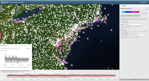
 Axiom helped publicly launch the new IOOS Environmental Sensor Map. This map integrates regional, national, and global real-time data across the IOOS enterprise. Data from observing systems operated by IOOS Regions and local data providers within these regional footprints can be directly accessed through the map. Overall, the map connects to over 31,000 stations providing the latest information on oceanographic and meteorological conditions. There are 71 unique parameters consolidated from over 115 national sensor that report more than 53 million observations weekly! Additional features included in the map are: